Hot tomorrow & Saturday with increased fire danger, then MUCH cooler next week!
September 8, 2022
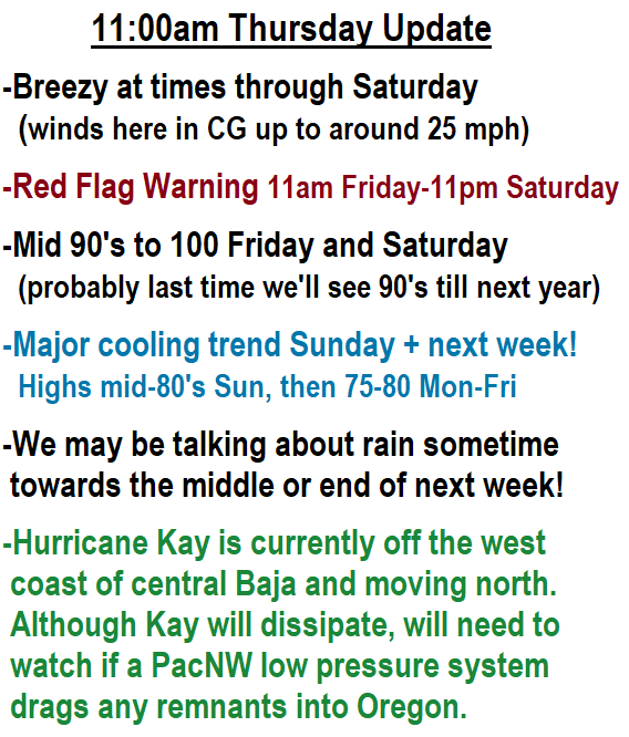
12:00pm Thursday: Concerned about the Fri/Sat wind event? Let's put things into perspective. No need to panic. This wind event is NOT as strong as the one that occurred in 2020.
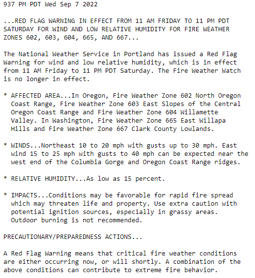
The National Weather Service has issued a Red Flag Warning for all of Oregon from the Cascades WEST to the coast for just a 36-hour period of 11am Friday to 11pm Saturday (see image below).
Red Flag Warning's are usually issued: during dry weather, when EASTERLY winds are expected to cause very low humidity, and when the combination of dry conditions + easterly winds can increase the fire danger and allow for rapid fire spread IF a fire were to occur.
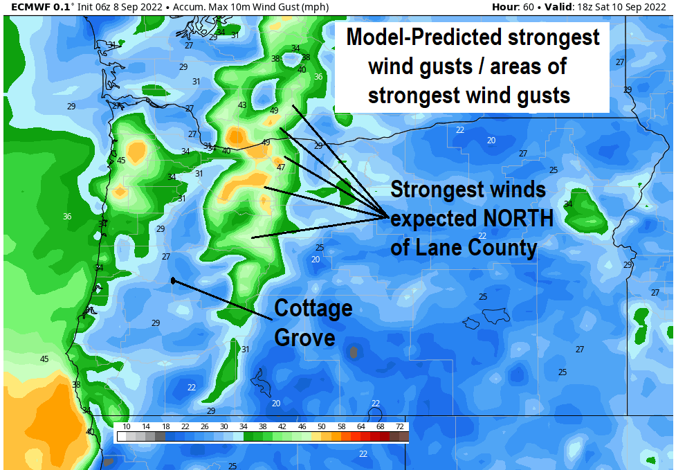
STRONGEST WINDS are expected to be NORTH of Lane County, in the Cascades (see image below). Also, strongest winds look to occur 6pm Friday to 6am Saturday. In Cottage Grove, it's expected to be breezy through Saturday with some wind gusts up to around 25 mph.
Although the predicted winds are stronger than what we typically see for this time of year, it's also NOT all that uncommon either. Combination of increasing contrast of colder air to the north and warmer air to the south (due to sun angle and less daylight) PLUS locations of low and/or high pressure allow stronger differences in pressure to form (pressure gradients) which results in increased wind speeds. The stronger the pressure gradient, the stronger the wind potential.
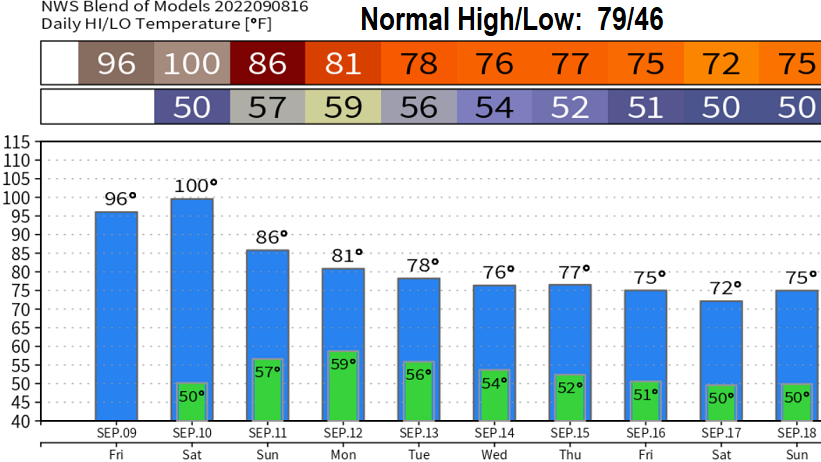
Hot Fri/Sat (95-100), then MUCH cooler Sunday (mid 80's). Looks like 75-80 all of next week with maybe some showers (will talk about this in an update on Sunday). After Saturday, I think we'll be done with 90° heat until next year.
Subscribe to receive updates when we post weather and preparedness updates to our blog. You can elect immediate, daily, or weekly emails. We anticipate a fairly low volume - 3 to 5 posts per week.