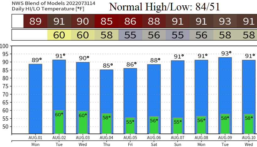
Sunday update: Hot, humid weather will continue through Friday. Highs mid-90's today, upper 80's - around 90 Mon-Wed, low-mid 80's Thur + Fri. Humidity should lessen quite a bit by next weekend but temperatures are expected to warm back into the low 90's as early as Saturday. There exists a small chance of an isolated shower or thunderstorm throughout the week. Best chances are this afternoon through Monday evening.
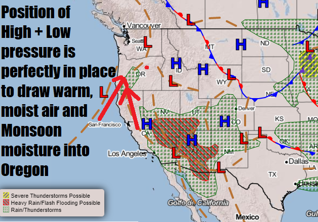
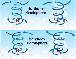
What's causing the heat and elevated humidity? High pressure is positioned just right over the intermountain west and desert southwest. Flow around high pressure is clockwise. Since we're on the western periphery of high pressure (flow south to north), it's drawing monsoon moisture northward into our area. Smoke from the fires in California is also caught up in this flow (smoke is above 5000'). Meanwhile, low pressure is offshore of the OR/CA border. Flow around low pressure is counter-clockwise. Therefore, we're getting a double whammy of both high and low pressure drawing up moist air, smoke, and monsoon moisture from the south and aiming such into Oregon.
Some hints that next week (Aug 8-12), high pressure might shift around into a favorable position to again draw monsoonal moisture into our area. Let's just get through this week and see how the pattern sets up for next week. Looks like the previous signals that August would have near normal temps flew out the window.