
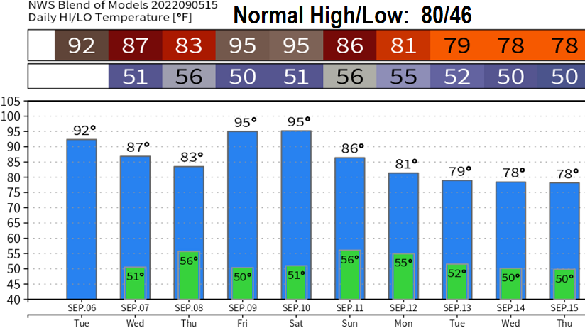
Enjoy today's cooler temperatures because hot weather returns tomorrow (Tuesday). This is expected to be the last week of 90-degree high temps until next year, as the pattern will undergo significant changes next weekend, especially on Sunday.
What's so interesting about next weekend? Saturday will be hot and muggy, then much cooler on Sunday but still humid. Tropical storm Kay (soon to be Hurricane Kay), currently south of Baja, will move northward and weaken by the time it reaches offshore central Baja. Starting on Friday, its remnants will get dragged north through California and then into Oregon on Sunday and next Monday. At the same time, a low pressure system just to our north may merge with Kay's remnants, or, at the least, help bring it northward. Two scenarios are possible: Kay's remnants are brought into our area and causes light showers and isolated thunderstorms, or, the low pressure system's tail end moves into our area and keeps Kay's remnants just to our east which allows for mountain thunderstorms.

NEXT WEEK, around Wednesday or Thursday (Sept 14-15), weak low pressure systems are expected to pass through the region. This will cause cloudy conditions at times (and maybe some light showers), keep high pressure out of our area, and ensure high temperatures are close to the normal at that time of 77°. In other words, it looks like we'll finally switch into a fall pattern around Wed/Thur of next week (Sept 14-15).