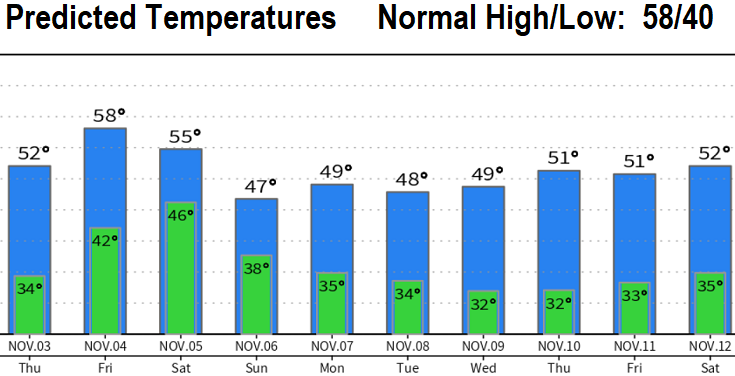
FROST: Low temperature range tonight into Thursday morning is 30-34. There is potential for frost tomorrow morning. It's a good idea to bring pets inside.
LOTS OF RAIN: A pair of very wet storm systems will bring 2-3” of rain between Friday afternoon or evening through Monday. This means rivers, creeks, and streams will be running high. The typical spots that flood during heavy rains may experience some flooding.
WINDY: Winds can gust up to 25 or 30 mph between late Friday morning and noon on Saturday. And again Sunday morning through Sunday afternoon. With saturated soils and leaves still on the trees, although unlikely, be mindful that the more weaker and compromised trees run some risk of damage.
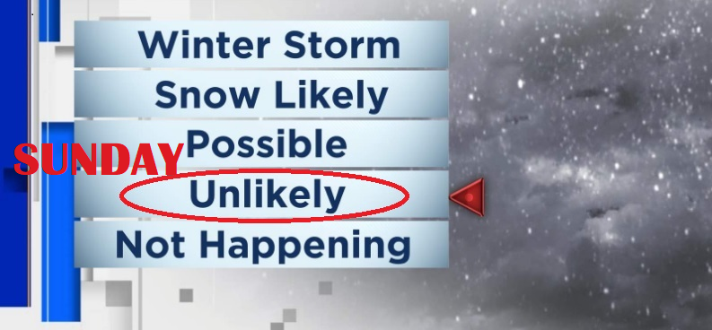
Will it snow on Sunday? Sunday's storm will be cold with low snow levels possibly lowering to 2000' during the afternoon. Snow here in Cottage Grove is unlikely, but if a cold pool of air passes over just right, a couple of 1500' locations could see some flakes or a light dusting. Snow levels Friday through Saturday morning will be above 6000', then 4000' Saturday evening.
Just some lingering showers possible on Tuesday, then it looks dry (right now) Tuesday night through the end of next week and into the following weekend. This may change, but I'm concerned with the anomalous high pressure we're seeing in the Pacific and parts of the west. Some of this is typical during a La Nina pattern, but the vast extent of the high pressure is affecting precipitation across the PacNW (October only had 40% of normal rainfall).