Storm system that's currently affecting the region is the coldest of the season so far. Scattered showers to about midnight with a rumble of thunder possible to about sunset. Isolated showers Monday morning. Snow levels tonight and Monday are expected to dip to around 3500', but by then most of the precipitation will have fallen. Total snowfall will vary from just a dusting at 3500-4500' to up to 1-3" at 5000', and 2-5" above 6000'. Cold air behind the current system will allow for a cool day on Monday. Under mostly clear to partly cloudy skies and calm winds Monday night, low temperatures are expected to bottom out at 31-34 with probable frost in the hours before sunrise Tuesday morning. Normal high/low temperatures are near 66/43. On average, we get 3.67" of rainfall during October. As of noon today (Sun Oct 10), we've had 0.63" of rain so far this month (this is also the Year-To-Date, since the new water year began on Oct 1).
Next storm system arrives later Tuesday, with light rain developing during the evening or early night. No wind concerns. Total new rainfall Tuesday evening to early afternoon on Wednesday looks to be 1/10-1/4". Highs Tuesday around 60, lows low 40's. Snow levels will be slightly higher with this system - varying between around 4000-5000' through Wednesday morning. Total new snowfall be a dusting at 4000' to a few inches at the higher elevations.
Wednesday evening through Saturday looks to be dry, but low temperatures may bottom out between 33-37 Thursday morning and again Friday morning. This means some patchy light frost is possible. There could also be areas of fog. Friday night will probably be a little warmer (upper 30's-low 40's) as an approaching weak low pressure system stirs up the lower atmosphere. High temps Wed/Thurs are expected to be in the mid 50's to around 60, then peak around the middle 60's Friday-Saturday.
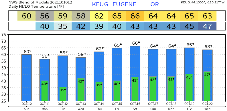
Sunday (Oct 17): A storm system may bring rain to our area. Doesn't look very cold over our area, but may contain more moisture than both today's system and the one coming in Tuesday night. Still some uncertainty as to strength and timing, so this will be addressed in my next update on Tuesday or Wednesday. Not exact, but temperatures roughly look like this over the next 10-days:
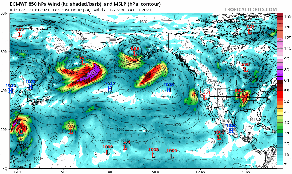
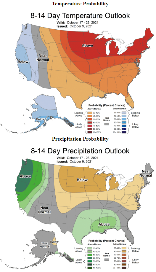
October 18 - 26: Some signal that things may become more active (especially after Oct 20 or 21). However keep in mind that accuracy this far into the future is low. Nonetheless, it appears that either a parent low pressure system may park somewhere in the Gulf of Alaska and send waves of energy (low pressure systems) through our region - or- several low pressure systems develop in the Bering Sea area (west of Alaska) and trek down through the PacNW. If this comes to fruition, this would be a more typical weather pattern for us. Here's temperature and precipitation probabilities for Oct 17-23. Above normal precipitation is favored for this period.
One model's prediction from 4:00am Mon Oct 11 to 4:00am Oct 20 (the last 10-days of the month may be active, as previously mentioned in this post):