Monday and Tuesday both had cool, fall-like mornings. Lows both days were 40, 41 (respectively). We have to go all the way back to June 10 when we last had a morning low near 41. Certainly a sign that fall is coming soon. The past several days of highs in the mid-70's to low-80's have been refreshing, especially since summer has generally been much hotter than normal. Nights are getting longer and the sun is less direct. Sunrise is now 6:29am and sunset's at 7:59pm. We're now losing about 2-3 minutes of daylight each day.
A couple of weak cold fronts will pass through the region later today (Wednesday) and on Thursday. No rain is expected locally (can't rule out a few sprinkles), but these systems will ensure that our relatively cooler temperatures continue through Friday. Highs will mostly stay between the mid 70's and about 80. Lows will be around 44-49. Although winds will stay on the light side, a few breezes of 10-15 mph are possible as each front passes through. Note: unexpected shifts of the wind can draw smoke into the area and cause haze.
Saturday and Sunday, moderate strength high pressure will briefly build in. This means we'll warm up a little, with highs around 83-89 and lows 45-50. There's still a little bit of uncertainty as to how warm it will get over the weekend. Also, data indicates that there could be a period of winds blowing from an easterly direction, so it may become hazy with a little smoke possible from the fires to our east.
Monday, a weak and dry low pressure system passes through the region. This will kick high pressure out of the area and high temperatures will gradually cool next week. This may also freshen up our air.
Scroll all the way down to see a few of the modeled temperature predictions.
Any rain in the picture?
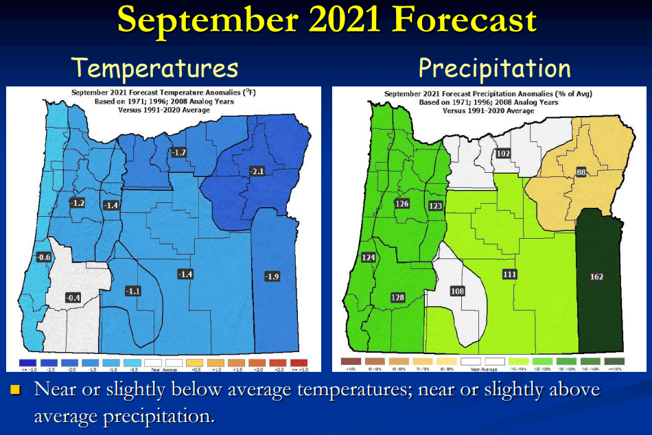
Not really. At least nothing significant over the next 10-days. Things may turn during the first week of September. Most data suggests near to slightly below normal temperatures and near to slightly above normal rainfall.
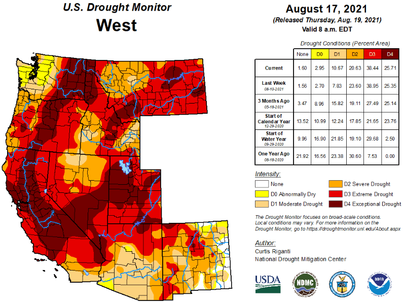
Drought
I've regularly posted Oregon's Drought Monitor, but check out how bad it is across the west:
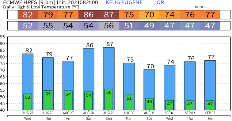
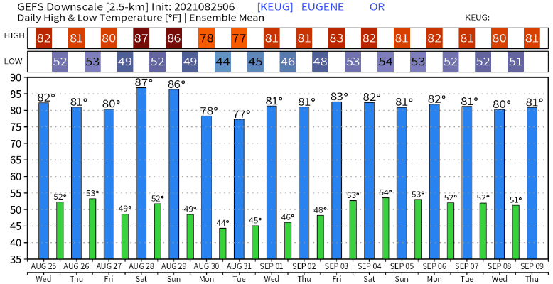
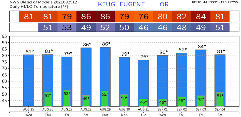
Modeled Temperature Predictions