Thur Jan 27: Well the caption above rhymed so what else was I supposed to say? Actually, it's part of an old 7Up ad. Anyway...except for some light rain on Sunday (1/10"-1/4"), an isolated shower on Tuesday afternoon, and maybe a few showers next Thursday (Feb 3), our very unusual dry stretch is expected to generally continue through about Feb 9. Seeing some signals that we may finally see a major pattern shift to wet around Feb 10, so keep your fingers crossed.
High temperatures through Saturday will largely depend on the extent of fog/low clouds and how quickly it clears. More sun = highs in the 50's. Less sun = low-mid 40's. Lows through Saturday morning 28-32 and 30-35 Saturday night. Sunday night 35-40, Monday night 31-35, then 28-32 Tuesday night. Normal high & low is 50/33.
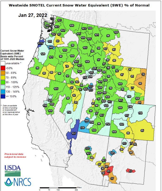
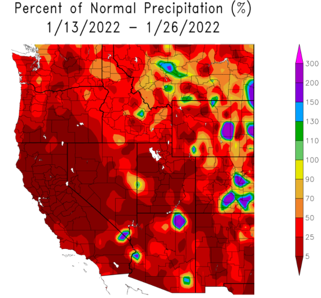
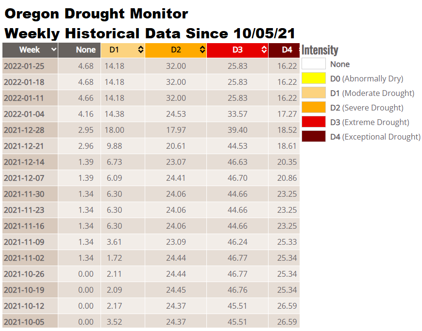
Check out some of the drought history and snow pack below. Notice drought hasn't improved since Jan 4th because we've been anomalously dry. I'm hoping Spring is as wet as models hint, otherwise we could see an early start to the fire season. But let's not go there yet since there's still hope for the faucet to get turned back on.
Snow Pack's still sitting pretty darn good: