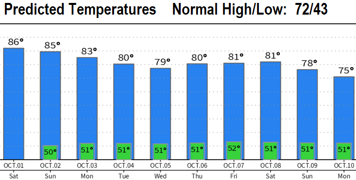
Enjoy the rain? We got 0.29" of total rainfall Wednesday & Thursday. Dry weather returns today (Friday) with noticeably warmer temperatures. In fact, summer-like high temps (80's) will return on Saturday and will continue into much of next week. Lows mid-upper 40's. Light breezes. Dry weather is expected through all of next week and probably into the following weekend. However, I think blocking high pressure in the North Pacific will finally break down and a more consistent "stormy" pattern develop sometime around Oct 8-10. Data is highly supportive of this.
Over the past 10 years or so, we're seeing more instances of strong, persistent high pressure in the North Pacific during the fall months that's hard to break down and therefore keeps the jet stream pointed well north of us (thus "blocks" storms that would otherwise affect us). This is also happening more often during the winter too, but affects California more than us here the PacNW during winter.