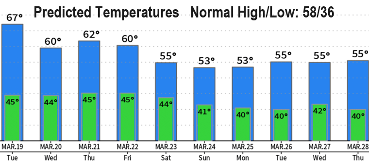

It's been a while (out of town). Looking dry through Tuesday and probably most or all of Wednesday (scattered showers Wed). A rainy pattern then returns on Thursday night, so Fri/Sat will be wet but no wind or low level (below 3000') snow concerns. A total of three to four storms will affect our region between Thursday and the end of the month (nothing drastic or extremely cold). Looking ahead to Easter Sunday, March 31, at this time it appears that it'll be wet and cool (may change).
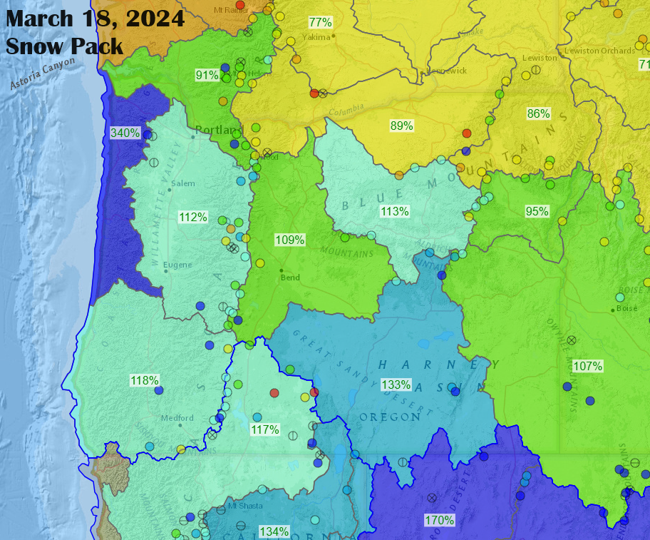
Snowpack looks great (see map below) and so does rainfall! We've recorded 34.11" of rain since the start of the water year on Oct 1. Normal to date is 33.05", so we're sitting really good right now. Model data suggests another 2" of rain is possible through the end of the month, so we'll be walking into April with strong precipitation numbers.