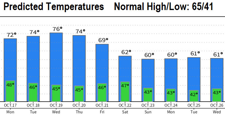
Ready for the rain? Sunday Oct 16: A series of 4-5 back-to-back storms is expected to plunge us into a rainy pattern Friday evening through at least the end of the month! It will also become much colder during the day than what we're seeing now (see predicted temperatures below - brrr!). No strong wind concerns at this time.
Until then, more of the same through Monday (night/morning fog, varying amounts of smoke, light winds, mild days, cold nights). Tuesday through Thursday, winds are expected to shift and "generally" blow smoke away from us. Might see more smoke later this week as winds shift ahead of the incoming system, so don't be surprised. Expect the Air Quality to fluctuate through Thursday or Friday.
How much rain? Friday night-Saturday looks like around 1/4-1/2". The water faucet may then open wide next Sunday through the following week with an additional 2-3" of rain possible. For the entire month of October, we normally get 3.67" of rain (so far we're at zero). If all goes according to plan, we should be done with the smoke and resultant bad air quality beginning next weekend. Fingers crossed!
La Nina will continue to affect global weather patterns for a third consecutive year (rare). BUT, the latest data predicts La Nina to rapidly dissipate during late winter which means higher potential for curve balls to be thrown at us during spring.