Lots of new people here in the group so I'll give a brief introduction of myself. I'm a Meteorologist with a Bachelor's Degree in Meteorology (2002) and Master's in Atmospheric Science (2005). I work out of my home office, here in Cottage Grove, and mostly do agricultural weather forecasting (which is very challenging). My wife and I love Cottage Grove and care about the community - that's why I do these posts and built the informational website grove411.com.
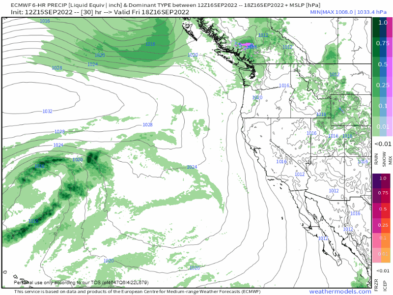
Dry through Friday with partly-mostly cloudy skies and light to calm winds. On Saturday, a low pressure system that's cut off from the jet stream will pass well to our west as it treks south then east into Northern California. For us, we'll likely just have clouds and "maybe" sprinkles or a few light showers (Sat+Sun). But don't bet on rain, since the chances here are pretty low due to the predicted offshore path of the system. Check out the GIF of the predicted track of the low pressure system:
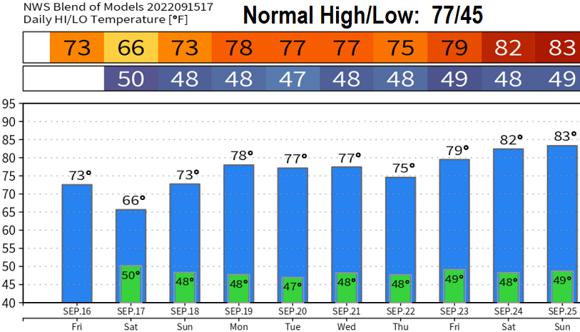
As this system slowly wobbles to the east, shower chances here may increase Monday night and Tuesday, based on the current projected path. Thereafter, looking more and more like high pressure will then become the dominant feature across the PacNW Wednesday of next week until possibly the end of the month. Check out the modeled 10-day temperature trend. We may have a few days of highs in the low 80's at the end of next week and into the following weekend.