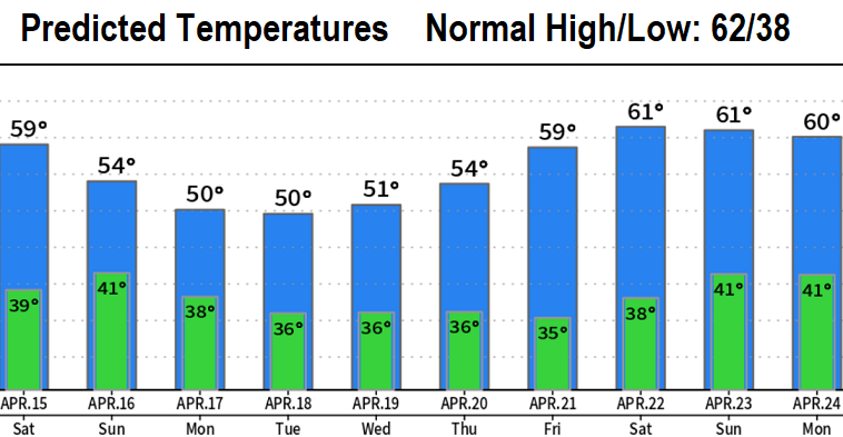

Happy Friday! Above picture isn't mine, but was on an Oregon travel website with no listed credit. Dry today and Saturday with varying amounts of cloudiness (there'll be some sunshine, especially today). A few storm systems will then bring colder temps and periods of rain after about 9:00am Sunday through Wednesday of next week. Starting to look like the end of next week into the following weekend may be dry with a warming trend. However, there's signals that the storm door may reopen around Monday April 24th.
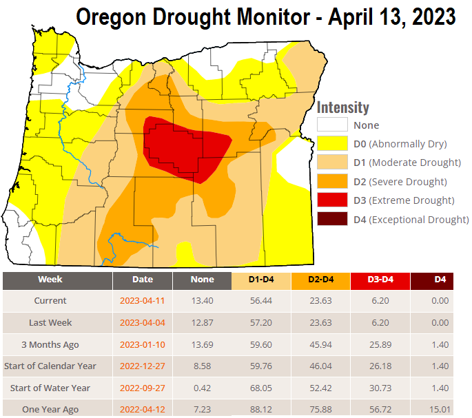
"Someday" we'll have nice stretch of spring temperatures. By the way, this delay of consistent spring-like temperatures doesn't mean that we'll go straight into hot summer temps. Check out the 10-day temperature and drought charts below. You're all awesome, have a wonderful day!


