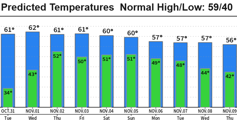
Tonight's the last night of freezing/near freezing low temps. It will stay dry through Halloween! In fact, a little warmer in the evening than what we've been seeing thanks to some cloud cover. Temperatures at sunset on Tuesday will be in the middle 50's and somewhere around 47-49 at 9:00pm. Very light breezes. Since 1892, 54% of Halloweens here have been wet.
Rain chances increase just before noon on Wednesday with solid rain moving in after 8:00pm (Wednesday). Looks like 1/2-2/3" Wed night through Thursday morning. Wind gusts 20 mph or less (no concerns). Additional storm systems will pass through Friday through Sunday, bringing 1"+ of additional rainfall and some wind gusts up to 25 mph at times (no worries). Typical fall storm systems. These will be "warm" storms so snow levels will be above 6000'.
At this time, more storms are possible next week but there's a small chance that high pressure may become re-established across the west and block storms for 3-5 days. Right now the pendulum leans towards more storms than dry weather. We desperately need the rain, so keep your fingers crossed.
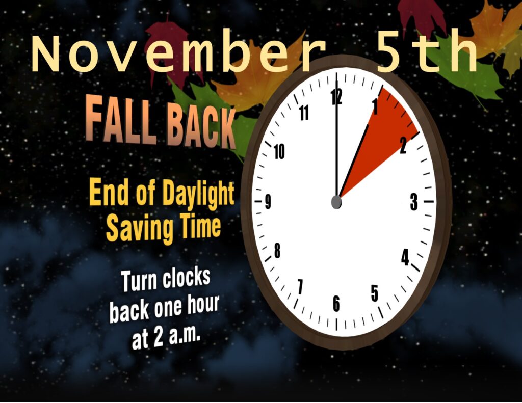
EXTRA HOUR OF SLEEP SUNDAY MORNING! Clocks go BACK one hour at 2:00am Sunday!