
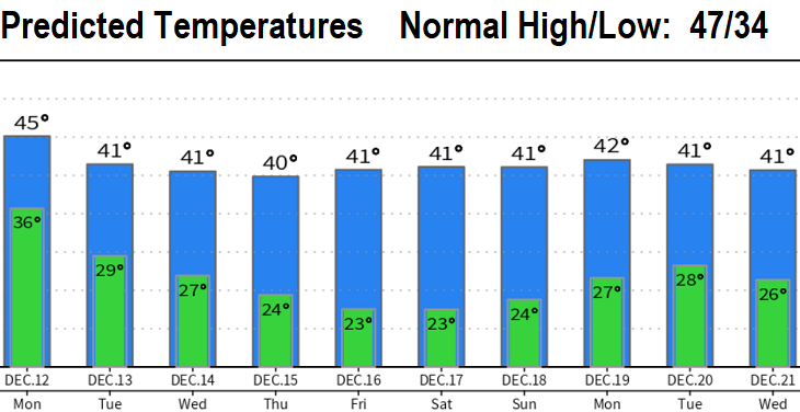
As of 11:00am Sunday, we've recorded 1.40" of rain from the current storm and the highest wind gust reached 24 mph. Expect light winds and 1/4" or less of showers into tomorrow morning (snow levels above 2000'). Dry and cold Monday afternoon through next weekend. In fact, latest data hints that we may be dry and cold through Dec 22 as anomalously strong high pressure around the Arctic circle sets up a blocking pattern in the North Pacific, PacNW, and parts of the western U.S.
White Christmas? Things then get interesting around Dec 23-26, as the blocking pattern is expected to weaken or break down and allow a storm (or storms) to pass through. If this occurs, with cold air already in place, the potential exists for a White Christmas around Dec 24/25/26 per current long rage data. Still way too far out for anything other than low accuracy, but something to keep an eye on nonetheless. Last year it snowed around Christmas, so stay tuned! Will it happen two years in a row?