This is time of year when the computer models can get a little goofy, due to the change of seasons and increased contrast between cold air to the north and warm air to the south. To no surprise, this morning's computer model data is all over the place. Therefore, the forecast over the next 7-10 days may undergo some adjustments. In general over the next 10-14 days, it looks like we'll have some nice breaks of dry weather between storm systems with areas of night/morning fog. Total rainfall over the next 10-days looks to be 1.50-2.50" (on average, we see 3.67" of rainfall throughout October -- currently we're at 0.97").
La Nina is still expected to become "official" in November or early December. There's increasing signals that the upcoming expected La Nina may peak solidly at "moderate" strength (some data hints "strong"), giving us better chances for above average precipitation this winter and spring.
Thursday-Saturday: Isolated light showers will remain possible into Thursday afternoon (zero to a few hundredths of an inch), then it looks dry Thursday evening through Saturday. Areas of night/morning fog. High temps mainly in the 60's, lows 37-40. Frost is not expected.
Sunday: The next storm system is expected to bring rain to the area on Sunday. This system may be breezy with some wind gusts to around 20 mph. Total rainfall looks to be 1/3-1/2". Snow levels 5000-6000', up to 4-6" of new snow at the highest elevations.
Monday onward: After some possible lingering showers Monday morning, the rest of the day looks dry. Another storm system will probably pass through later Tuesday or early Wednesday (Oct 20). There's some preliminary indications that this may be a medium to strong strength system with some wind gusts of 20-25 mph. Another system might then affect the region later Thursday or Friday of next week (Oct 21-22), possibly followed by another system on Sat Oct 23. The last week of October may be active, giving hope that we can close out the month with average or above average precipitation.
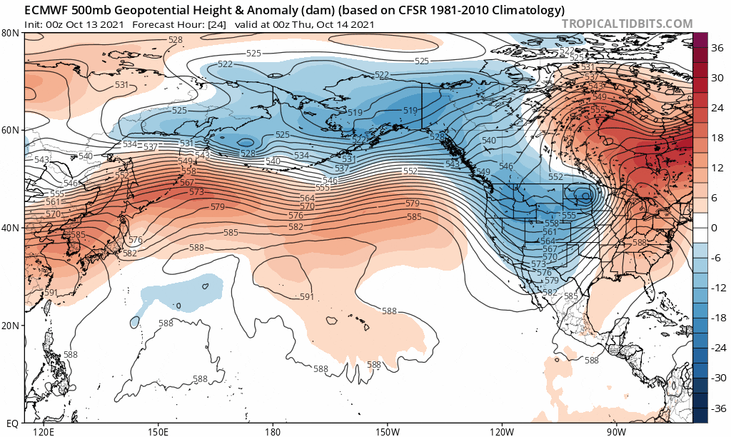
★★This model (pressure differences between the surface and ~18,000 feet) indicates better chances of low pressure (storms) affecting the PacNW through Oct 23 (as indicated in blue) as opposed to high pressure (red) keeping us dry:
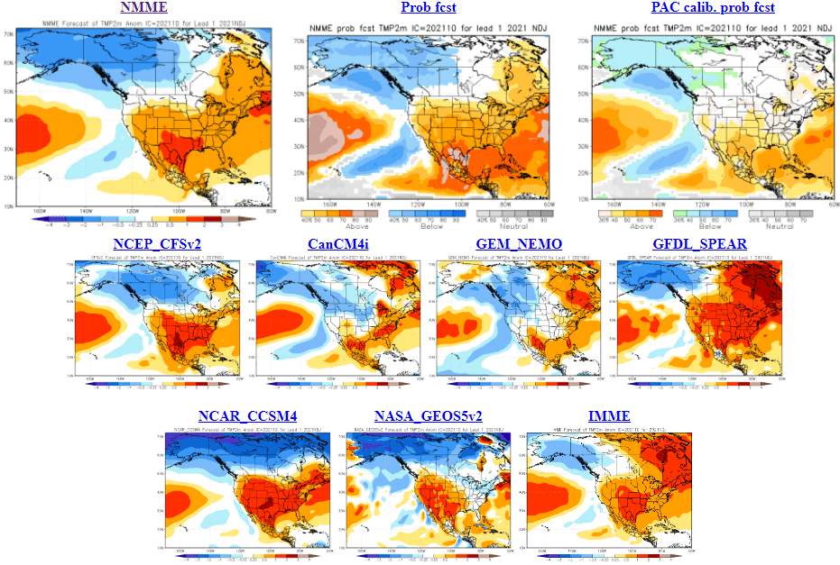
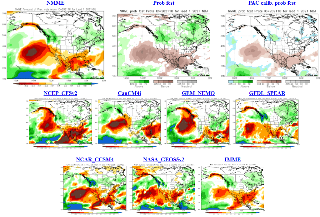
November-December-January: As I always say, outlooks have no skill and are low accuracy. That said, most of the climate models lean towards above average precipitation and near average temperatures for the Nov-Dec-Jan period.
★★Here's a 9-model suite of Probability of Above, Below, or Normal PRECIPITATION for the Nov-Dec-Jan period (green/blue= wetter than normal, orange/red= drier than normal, clear = near normal):
★★SAME 9-model suite of Probability of Above, Below, or Normal TEMPERATURES for the Nov-Dec-Jan period (blue= cooler than normal, orange= warmer than normal, clear = near normal):