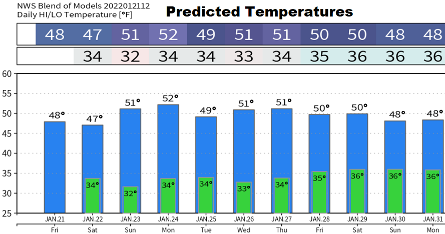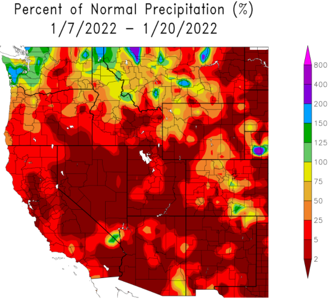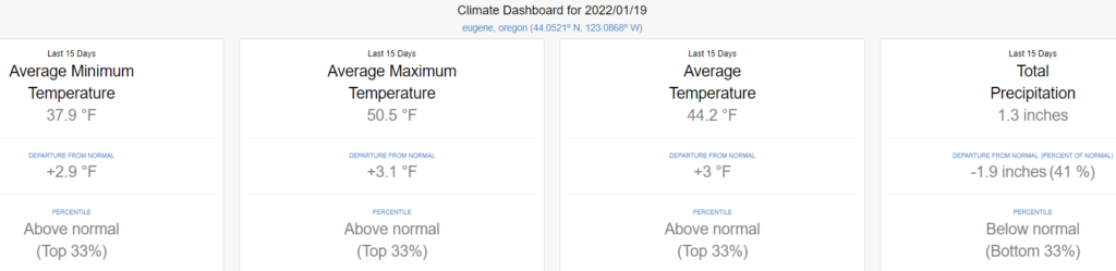
Fri Jan 21: Dry through the end of NEXT week. Over the weekend, night/morning fog and/or low clouds is expected but "should" give way to at least some afternoon sunshine. As I'm sure you've noticed, we've been much drier than normal these past two weeks (see charts below). Below normal precipitation will continue through the end of the month, although a pattern change to wet is expected on Jan 30 or 31.
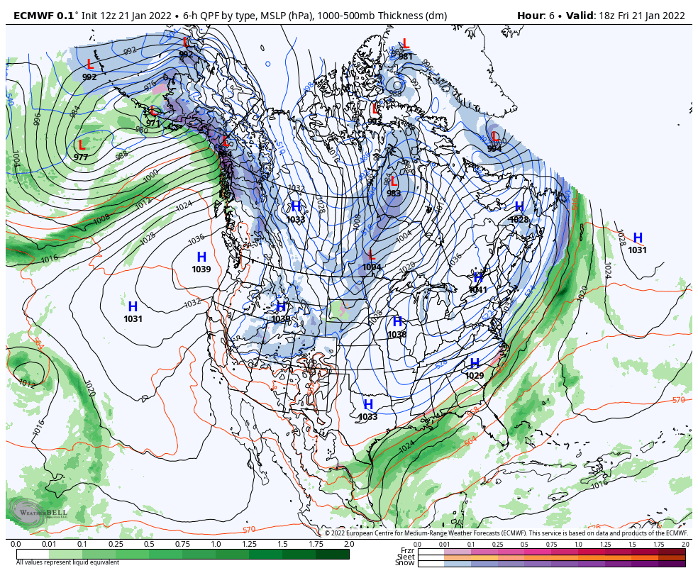
The GIF image clearly shows all the anomalous western high pressure that's keeping the jet stream way up north and blocking storms that would otherwise be bringing us precipitation. Although blocking high pressure is typical across portions of the west during a La Nina, we usually don't see it this far north for extended periods of time.
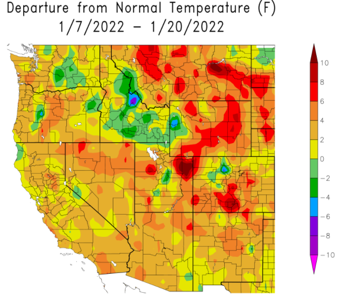
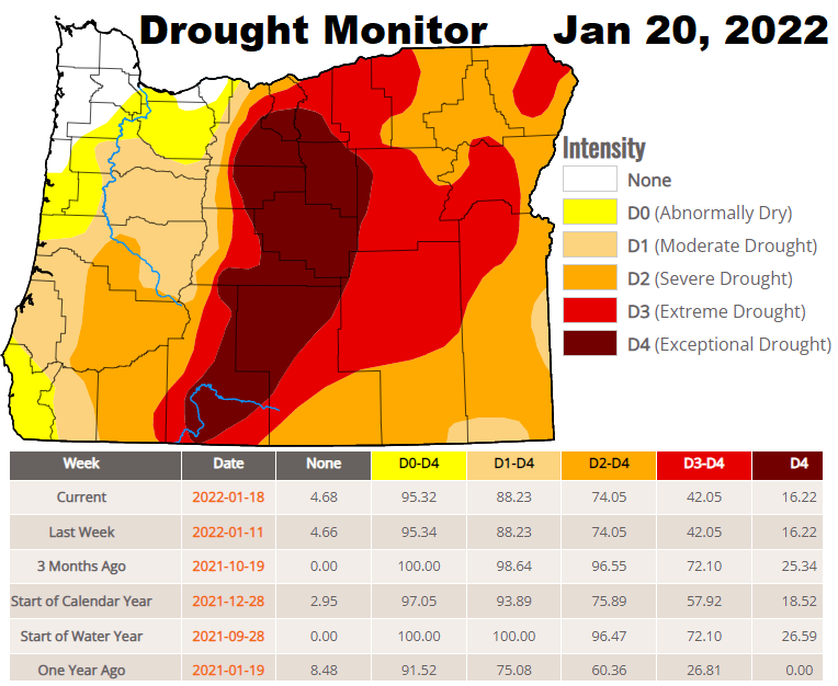
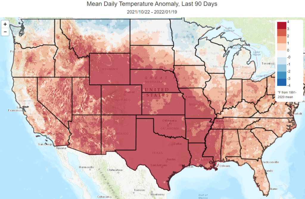
Since the start of the Water Year on Oct 1, we've recorded 23.49" of precipitation. Normal to date is 22.88, so we're 103% of normal. Check out the below images. Notice the warmer temperature anomalies / departures from normal. Outlooks for February suggest better odds for at least normal to slightly above normal precipitation but with below normal temperatures. Similar odds extend into March. Keep in mind outlooks are preliminary and low accuracy. Keep your fingers crossed that the water faucet opens Feb-May so that we can see more drought improvement.