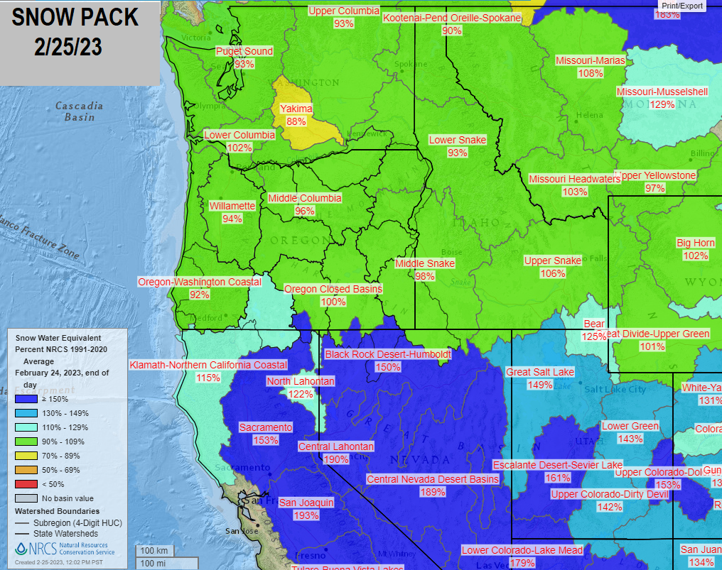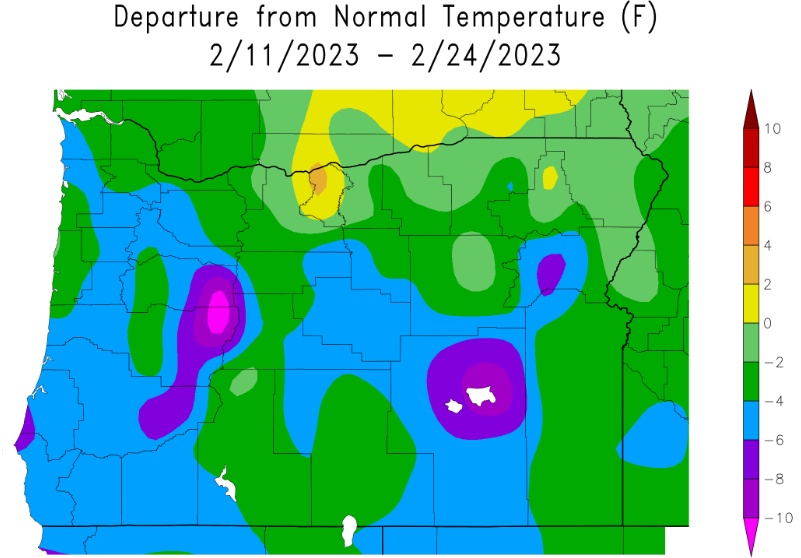
Saturday update (next update noon Sunday): Lots to talk about and a complex pattern setting up. Snow is possible in Cottage Grove at times through Wednesday morning (best chances Tuesday evening through Wednesday morning). By the way, we've recorded 18.19" of precipitation here in Cottage Grove; normal to date is 29.36". So, yes, we're running quite a bit behind (only at 62% of normal). It's highly unlikely we'll make this up over the next 60-days, as there's simply no signals right now for any significant rain events through April. Check out the info on the charts and maps below to see where things stand with the snow pack and precipitation/temperatures.
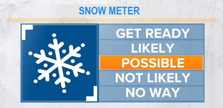
SNOW:
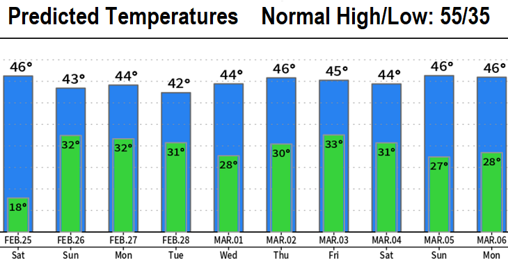
TEMPERATURES: 18° was the low temperature this morning (4:30am). Much below normal temperatures are expected through at least March 12 (as it looks now).
WIND: Gusts up to 30 mph at times. Breeziest periods look to be tonight, Sunday night, Monday and Monday night.