
Updated 3:00pm Friday, next update noon Saturday
System #1: Saturday night / Sunday morning (snow levels may dip to near 700-900' at times). Range of possible snow in Cottage Grove is zero to a dusting (chances are very low).
System #2: Sunday night through Tuesday night. Deja vu: this system is expected to stall near Astoria just like the last one that was supposed to bring us snow this past Wed/Thur (but is also not the exact same setup). Snow levels are expected to drop to 500-600' at times due to cold air coming in. With the system stalling around Astoria, it will spin moisture into our area and probably "mini" low pressure systems. Range of possible snow totals are a dusting to 5". Good chance that we'll see some snow during this time. More details on this at around noon on Saturday and Sunday.
RAIN TOTALS: Sat night-Sun morning, 1/2" of rain. Sunday night through Tuesday up to 2/3" of rain.
WINDS: Up to 20 mph Saturday night, then up to 30 mph on Monday.
ANOTHER TWO STORMS are possible Wednesday night through Sunday of next weekend (Mar 5). At this time, there are indications that lowland snow may be possible sometime around next Friday and the following Saturday (preliminary).
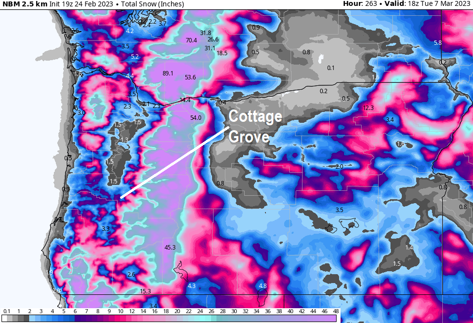
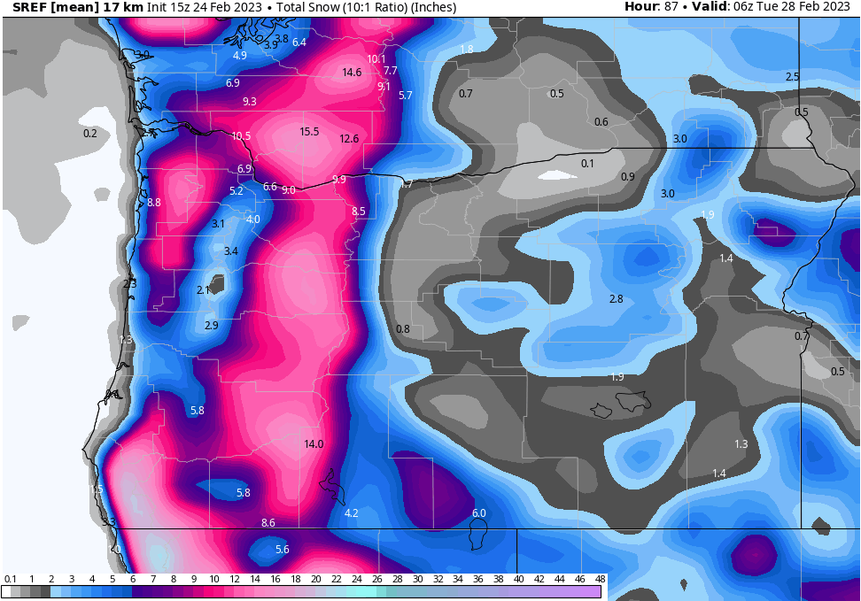
To give you a small idea of what I look at, here's a couple of screenshots that are just two of the many computer models that us Meteorologists use. Lowland snow in Oregon is extremely hard to predict because so many ingredients need to come together just right and the dynamics of a storm system can change rapidly.