Yes, there may be at least two opportunities for snow - per updated data this afternoon. Possibly on Monday and/or Tuesday, and again the following Wednesday and/or Thursday (Dec 21/22). Long range data is also hinting on a Christmas Day storm which may have low snow levels.
Temperatures are also expected to become much colder next week, as Arctic Air moves south into the U.S. There's still some uncertainties as to how far west this very cold air will push and the computer models are polarized (for example some show low temps next week near 15°, others hint at mid 20's). Will take a few days to get this more sorted out.
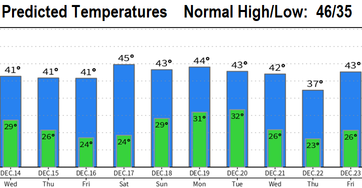
For the rest of this week, predicted temperatures may be affected by the night/morning fog and low cloud pattern that we're currently in (low clouds that don't burn off and remain in place overnight could act as a lid and not allow it to get as cold as predicted during the night). Therefore, overnight lows may be a it warmer than predicted and daytime highs could, conversely, be lower (again, unless low clouds clear at night).
Hazards over the next several days include icy roads & sidewalks, dense fog, and freezing fog. Overpasses and bridges freeze quicker than the road.