
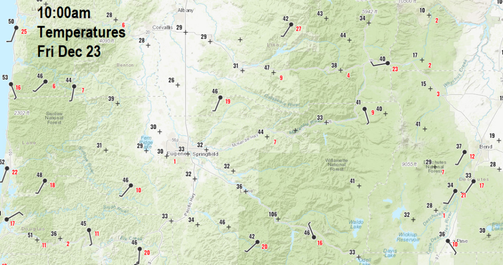
Yes, for Cottage Grove! The freezing rain event is over in Cottage Grove, temperatures have warmed to above freezing south of Eugene and we're finally thawing out (see 10am temperature map). However, Eugene may continue to have ice problems until early afternoon and until mid/late-afternoon north of Eugene to Salem and late evening/early night in Portland. Check out the 10am temperature map and you'll see that mountain locations are in the 40's, clearly showing the colder air trapped below the warmer air.
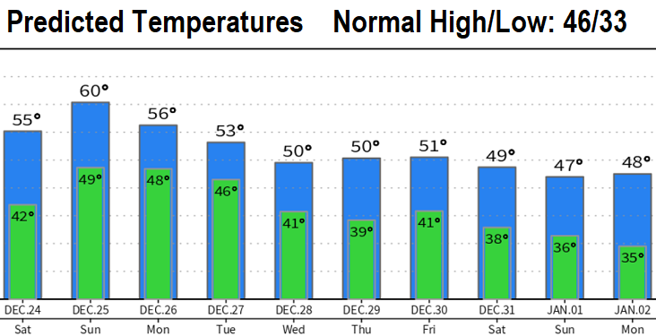
TEMPERATURES will be 10+ degrees above normal tonight, Christmas Eve, Christmas Day, and Monday.
RAIN/SHOWERS Light shower chances will stick around to 9pm this evening, then rain will develop after 10am tomorrow (Christmas Eve) with showers or light rain lingering into early afternoon on Christmas Day (Sunday). Rain develops again early Monday morning.
TOTAL RAINFALL through Monday 1-2"
SNOW LEVELS are expected to remain above all regional passes this afternoon through Monday.
WINDS through Monday morning will be light with some gusts to 20 mph at times. Becoming breezy/windy Monday night.
STRONG STORM TUESDAY: A strong storm is expected to bring wind gusts possibly up to 40mph on Monday night and Tuesday with heavy rain totaling 1-2" (Monday night through Wednesday). Snow levels will be above 5000'. More details about this with a post on Christmas Day.
ADDITIONAL STORMS may pass through on Thursday, New Year's Eve, and possibly New Year's Day, possibly adding up to another 2" of combined rainfall. This is good news for our drought and rainfall deficit.