Don't shoot the messenger, I'm here only to give you information. We have a few more days of relatively cooler weather (highs mid 70's to low 80's, lows mostly low to mid 50's). There's also the possibility of a few isolated light showers or sprinkles Saturday night into Sunday morning. So enjoy this cool down while you can because it's going to heat up next week. By the way, the normal high/low temperatures are near 85/52.
Heatwave Next Week
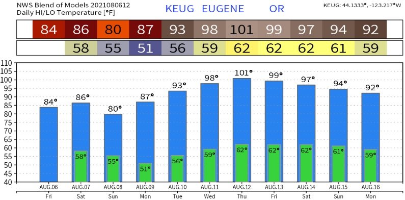
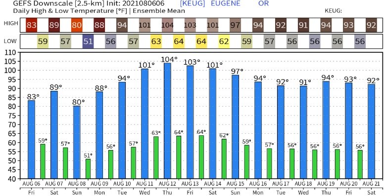
Many of the computer models are predicting 95-100 degree heat Wednesday and Thursday as strong high pressure builds into the west. The latest data is also hinting that the mid-week heatwave may extend into the following weekend (Fri Aug 13 - Sun Aug 16). I should note that high pressure this time of year is extremely hard to break down. The jet stream is more north, typically hovering near the US/Canadian border, and its wind speeds are slower than during winter. Low pressure systems are also weaker. All this combined gives high pressure the upper hand, which is why we often see areas of extended heatwaves during the summer months. Expect an update later Sunday or on Monday to freshen up temperature predictions.
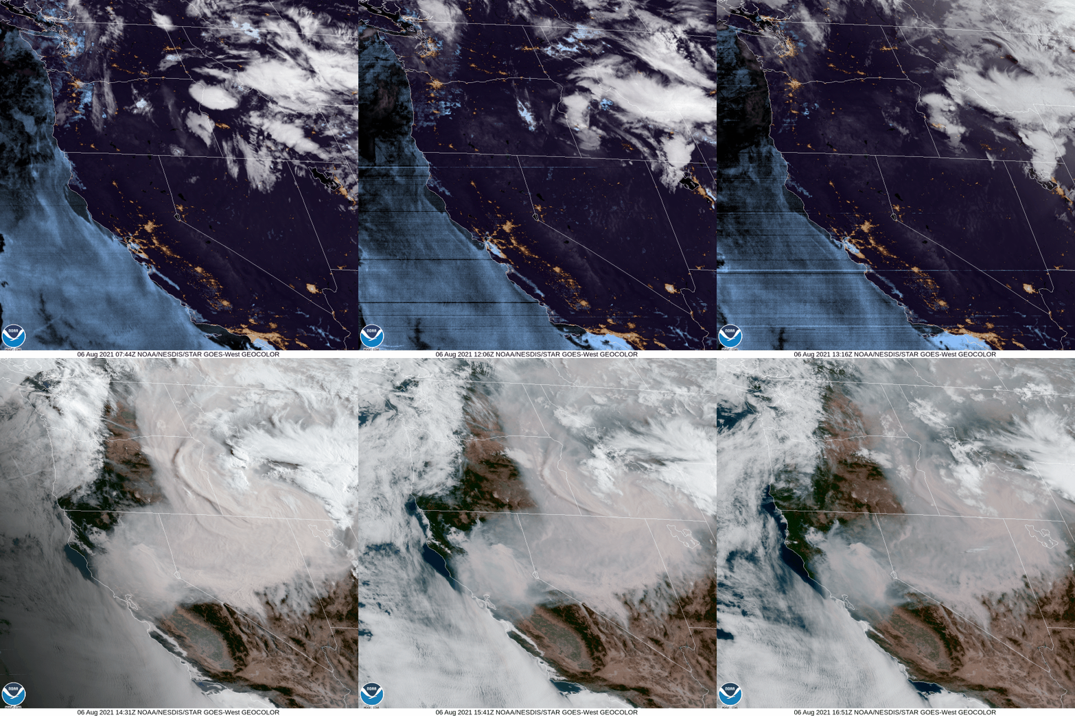
Looking at the satellite imagery, notice the absence of smoke across western Oregon, compliments of the winds shifting from the storm system that began affecting the region yesterday (Thursday). Another couple of systems will pass through between now and Sunday. Although winds could briefly shift, bringing a bit of smoke into the area at times, overall these systems will help renew transporting fresher air into the area.

Here's a couple more model-predicted temperatures for the next 10-14 days:


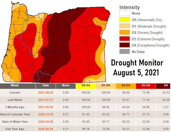
Drought has slightly increased since last week:
