
Our storm door is expected to remain open for at least the next 10-14 days, promising that low pressure systems will regularly pass through the region. The water year runs October 1 through September 30. September was active, adding 2.97" of rainfall. We therefore closed out the 2020-21 Water Year at 36.53" of rainfall (average is 45.43", so we were 80% of normal). For October, the average monthly rainfall is 3.67" and this may be achieved if the pattern holds steady with low pressure systems passing through about every 1-4 days. The annual precipitation gauge reset to 0.00" on October 1st. Last year, 2020, October only received 1.88" of rainfall (Sept 2020 had 1.74").
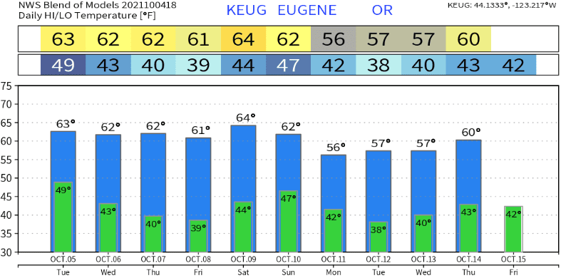
The first system of the month will arrive tomorrow (Tuesday). Although rain is expected to develop during the morning, the front may slow down and hold the onset of precipitation until the afternoon. Rainfall will be light, totaling between 1/10" and 1/4" with snow levels down to near 4500-5000'. Snow will be minimal, with only 1-3" at the higher elevations. No wind concerns, as gusts should stay under 15 or 20 mph. Tuesday night looks dry, but there could be a few very light showers around on Wednesday. High temperatures tomorrow (Tuesday) will be around 60-65 with lows upper 30's to low 40's. Wednesday will be a bit cooler - highs upper 50's to low 60's, lows mid-upper 30's. Areas of fog will be possible Wednesday morning, but better chances exist Wednesday night and again Thursday night.
Frost Thursday morning? If skies are mostly clear Wednesday night and winds go calm, we could see some light frost on Thursday morning. High temps Thursday will be in the upper 50's-low 60's with lows mid-upper 30's. Areas of fog will continue to remain possible. Any fog/cloud cover Wednesday night and/or Thursday night may affect forecast lows.
Friday, light shower chances increase during afternoon or evening and end by about mid-morning on Saturday. In terms of rainfall from this system, expect nothing to a few hundredths of an inch. Snow levels will stay above 5500' with just a dusting. At this time, Saturday looks to be a dry day.
Sunday-Monday: A stronger system arrives with rain developing Sunday morning and showers continuing to about sunset on Monday. Total rainfall looks to be around 1/2-1". This also looks like a colder storm, so snow levels could dip down to 4000-5000 feet with 2-6" possible at the higher elevations. Although we may see a few wind gusts up to 25 mph, right now this doesn't appear to be a windy system (although this could change in the coming days as refined data comes in).
Next Tuesday (Oct 12) will probably be dry (at least that's how it looks now). However, another low pressure system is expected to pass through on Wednesday (Oct 13). An additional system or two looks to affect the region later next week into the following weekend (Oct 15-16). Thereafter, high pressure may build in over the North Pacific for 2-4 days which would give us a little break. Data then signals that an active pattern may kick in sometime around October 20-23 through the end of the month.
Not exact, but temperatures look like this over the next 10-days:
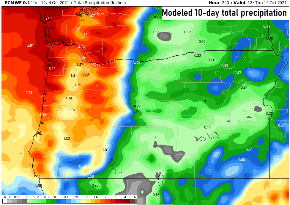
Modeled Total Combined Precipitation to 5:00am Thurs Oct 14:
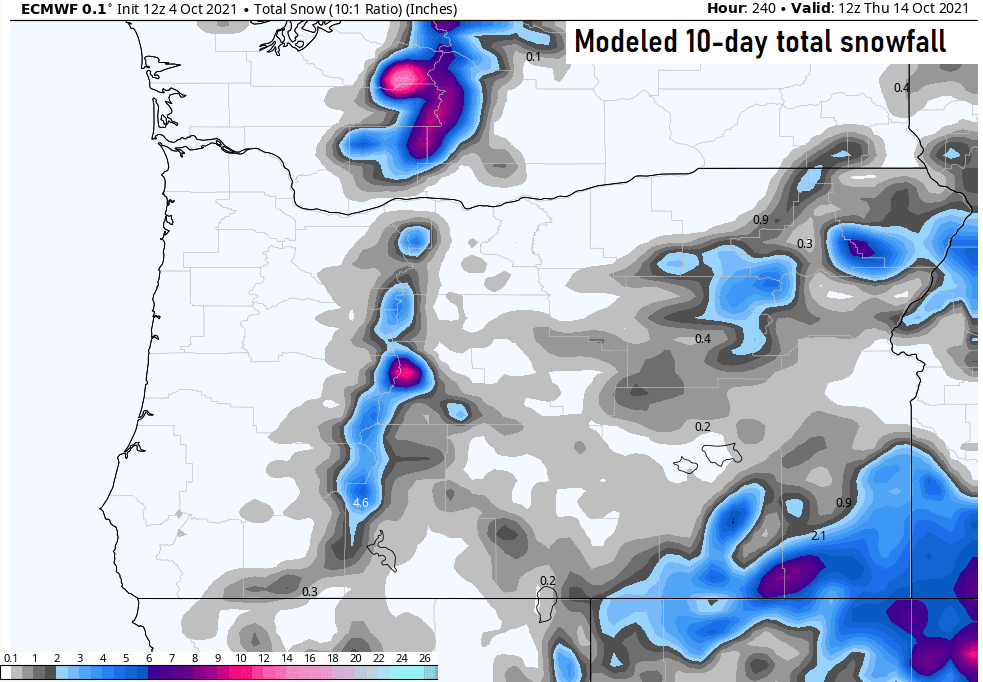
Modeled Total Combined Snowfall to 5:00am Thurs Oct 14:
Next update expected on Wednesday or Thursday.