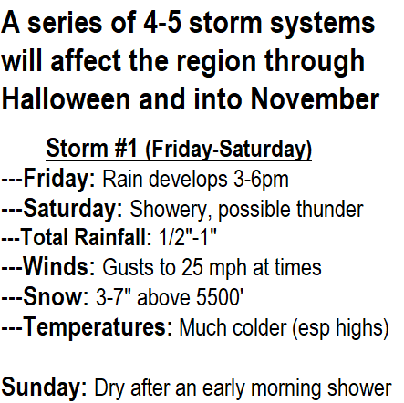
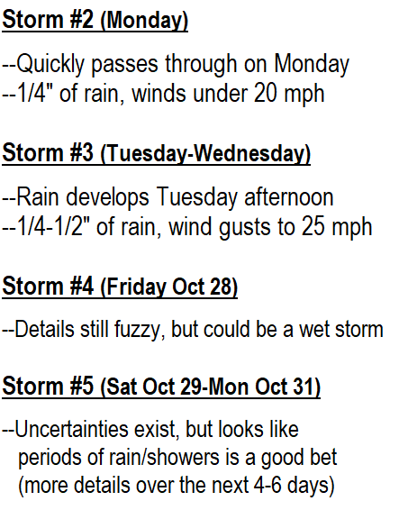
Thursday (Oct 20): Smoky again today with poor air quality. A series of five storm systems then look to affect the area Friday afternoon through Halloween and into November. FYI, normal rainfall for the month of October is 3.67". Currently we're at 0" so far. These storms will help, but probably won't bring more than 2-2.50" (expect October to still end with below normal rainfall).
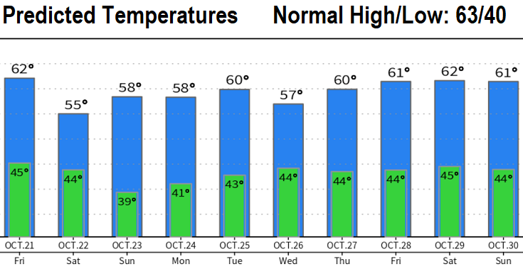
Storm #1: Rain develops sometime Friday afternoon and changes over to showers Saturday morning. Looks like 1/2-1" of total rainfall through Saturday night. Maybe a rumble of thunder on Saturday. Winds can gust to 25 mph at times. Much cooler (especially high temps - see predicted temperatures). This system will also bring our first snow of the season to the Cascades, looks like 3-7" above 5500'.
Dry on Sunday after a possible morning lingering shower.
Scroll through the images below for details and predicted temperatures.
A colleague in Panama City Beach (Florida) sent me this. Thought you'd get a chuckle!