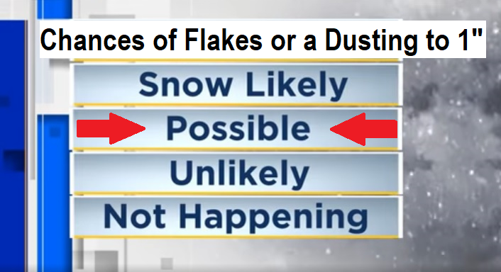
🔵Tonight into Monday morning, there's a chance for us to get a dusting to 1" of snow via hit/miss showers. Lessor chance Monday night - Tuesday morning.
🔴Scattered to numerous showers will continue through Tuesday with some peeks of sun. Isolated thunderstorms with small hail and gusty winds. No wind concerns - breezes 15 mph or less (higher around thunderstorms).
💧Up to 3/4" of additional rainfall through Tuesday. As of 11am Sunday, we've recorded 1.49" of rain since Friday. Water year to date rain total is 26.17" (normal is 35.38"). It's too late in the season for us to make up our rainfall deficit. Odds favor below normal precipitation for April and May (as a whole, not set in stone).
🔶Wednesday looks dry to about 5pm, then rain chances increase as the next couple of storms move in. Periods of rain/showers Wednesday evening through Friday. About 1" of total rain Wed-Fri. These will be warmer systems, so snow is not expected below 2000' (in fact, snow levels will probably mostly be above 3000' and only dip to near 2000/2500' at times).
🔆EASTER WEEKEND: Right now looks like some showers possible on Saturday to about sunset, then dry Saturday night through Easter and into the following week. Plenty of sunshine is expected for Easter Sunday! Temperatures will be much warmer. Highs possibly near 70 on Easter and the following Monday!