
Thursday March 21: Rainy pattern returns but looking dry for Easter Sunday (March 31) through about April 3. Four storms will affect the entire region/state through Sat March 30, bringing around 2" of total rainfall between now and then. Wind gusts should stay at 20 mph or less, which isn't strong. Snow levels above 5000' through Friday then 3000-4000' Saturday onward. Can't rule out a thunderstorm here - especially Friday/Saturday. Cooler Saturday through next week, but lows well above freezing. More or less typical Spring weather.
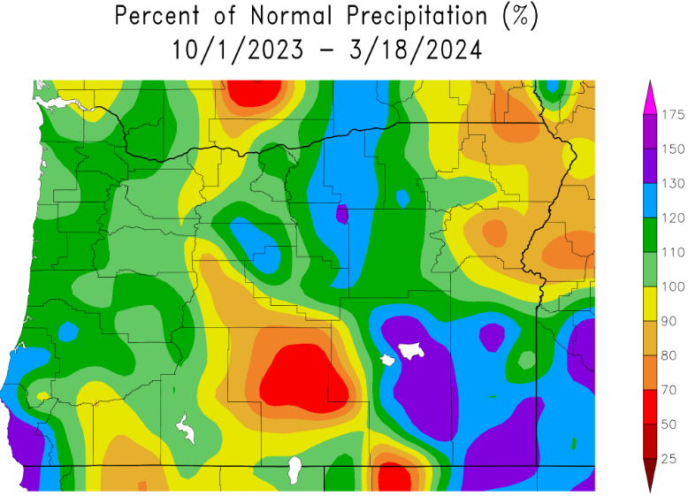
Snowpack across the entire state is over 100% of average. Check out the precipitation map. Normal high/low temp 58/36. Sunrise 7:12am, sunset 7:27pm.
