
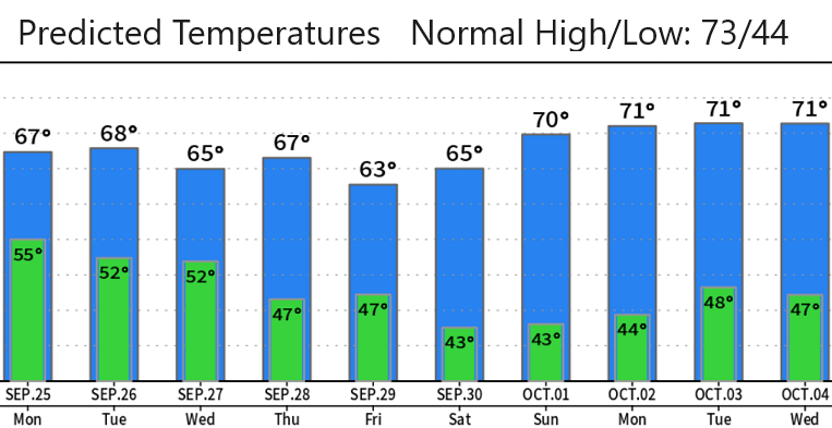
Sunday Sept 24: Smoke and unhealthy air quality has been affecting the area over the past couple of days due to the overall PacNW wind flow blowing from the south and transporting smoke from fires into our area. The first seasonably strong storm of the season is on track! This system is set to bring us the most amount of rain that we've seen since April: we only had 0.46" of rainfall in May, 0.30" in June, 0.00 for July, and 0.30" for August (the month of April had 5.46"). Snow levels this week are expected to stay above the passes, fluctuating at 7000-9000' (may briefly dip to 6500').
A couple of friends sent me these pictures - thought it was funny enough to share with you.
