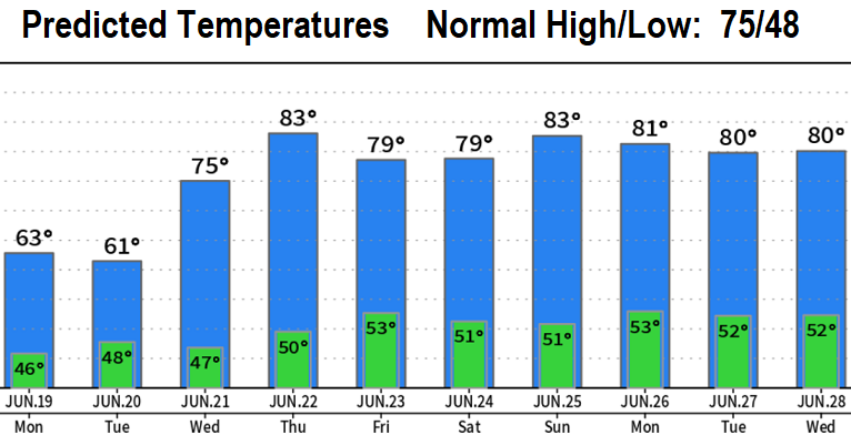

No, you're not dreaming! That water falling from the sky is rain! As I mentioned in Friday's post, much cooler temperatures and showers are in the picture today (Sunday) through Tuesday. Total combined rainfall through Tuesday is expected to be 1/4" or less. There also exists a small chance of a thunderstorm which could cause a brief heavy downpour, small hail, and gusty winds. Take a look at the 10-day predicted temperature chart. Notice the nice warm-up beginning Wednesday. By the way, I don't see any excessive heat through the first week of July. NOT set in stone, but about 2/3 of the long range data gives signals that the end of June and first few days of July may have below normal temperatures. The remaining 1/3 suggests high temps near 90, but nothing excessively hot. Which do you prefer?
