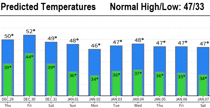
To sum up: periods of rain & showers over the next 10 days (through Jan 7) as about six low pressure systems affect the region. DRY New Year's Eve after 6:00pm and all of New Year's Day. At this time, total rainfall over the next 10-days should be under 3" so flooding concerns are minimal. The Cascades could see another 2-4' of new snow! Snow levels vary at 3000-6000', so no lowland snow.
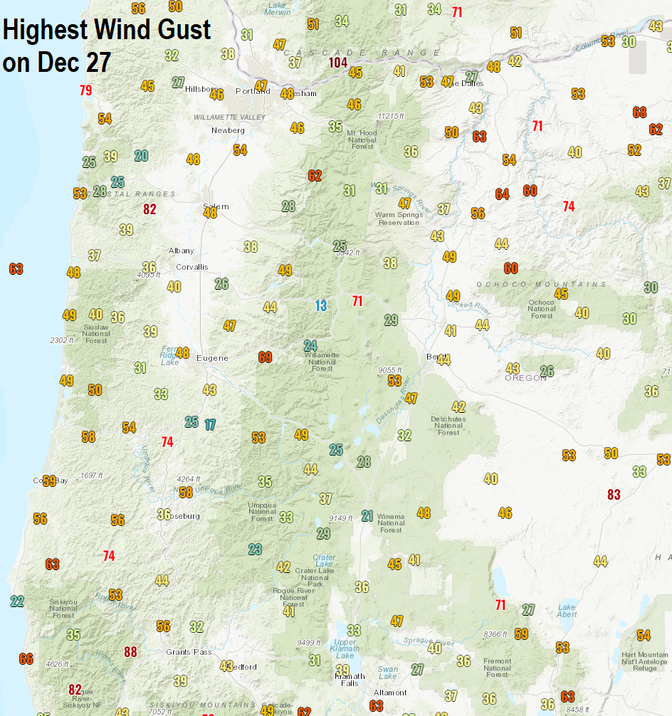
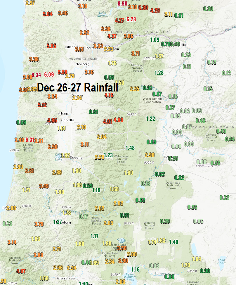
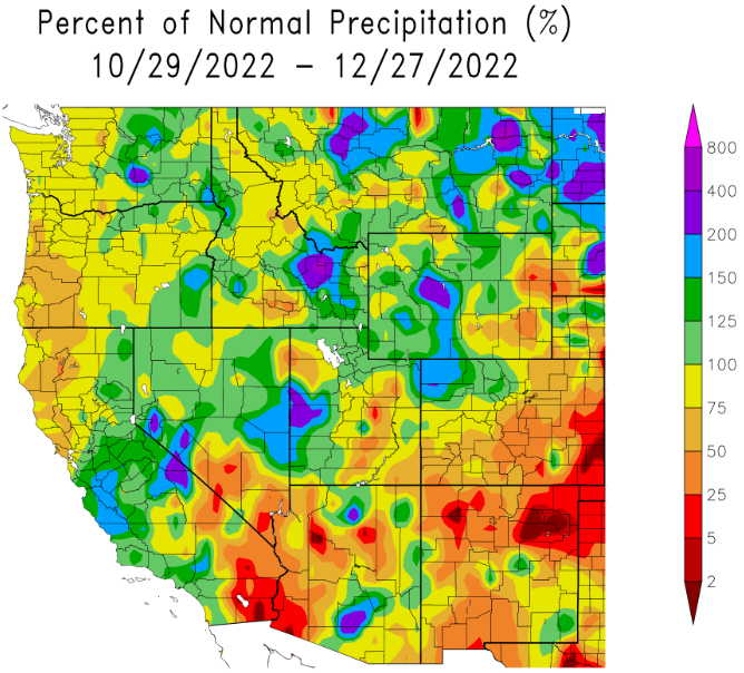
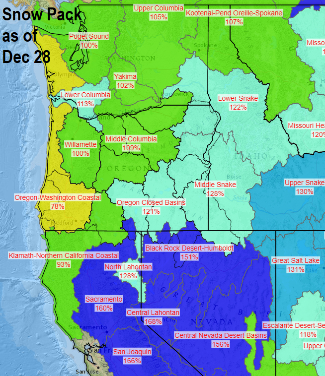
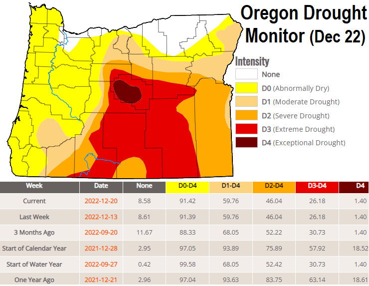
Check out the data charts below; lots of information for you! Note that since these past couple of storms have been relatively warm, the snow pack didn't go up. In fact, because snow levels were so high, all the rain we had melted a little bit of the snow and we therefore lost a little bit of the snow pack. Storm rain total in Cottage Grove was 2.22", see the map below for the rest of the region. As of Dec 28, we've recorded 12.89" of precipitation. Normal to date is 17.30", which means we're at 75% of where we should be. As you look at the Drought Monitor, you'll see there's been little change over the past few months because of both less than normal precipitation and some extended dry spells that we had.
