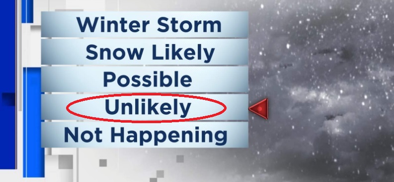
Coldest Arctic Air is now expected to remain just north of Eugene. Therefore, as of the time of this post, best chances for light lowland snow is north of Eugene and especially north of Salem. Chances here aren't zero, either, if cold air slips more south. Locally, snow levels through Tuesday will roller-coaster between 1000 and 2500 feet, then be around 3000' on Wednesday. If anything falls here, it would be just some flakes to a dusting. About 5 low pressure systems will affect the region through Christmas day. Not looking like a lot of total combined rainfall, as data suggests such will be 1" to 1.50", with the bulk of that occurring on Christmas day/night.
WINDS: No wind concerns through Christmas day. Just some breezes as each storm passes through, and maybe a few gusts to about 20 mph. Nothing to worry about.
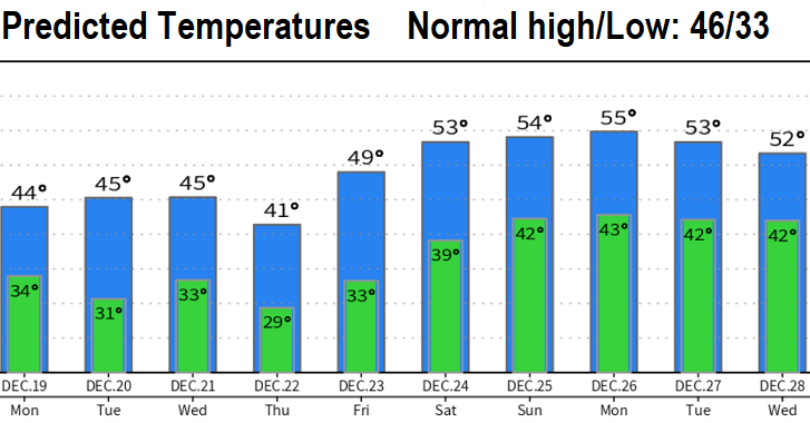
TRAVEL WEATHER: If you're traveling, the biggest challenges are from Thursday afternoon through Friday, freezing rain and snow will affect the Cascades eastward and Salem northward could have some minor issues with freezing rain, including on I-5. This doesn't look like a major event at this time WEST of the Cascades, but to the EAST, a more solid freezing rain/light snow event is expected. Heavy snow is unlikely. Snow levels Friday night through Dec 26 should be above the passes with no more threat of freezing rain.
WINTER SOLSTICE: Wednesday (Dec 21) at 1:47pm