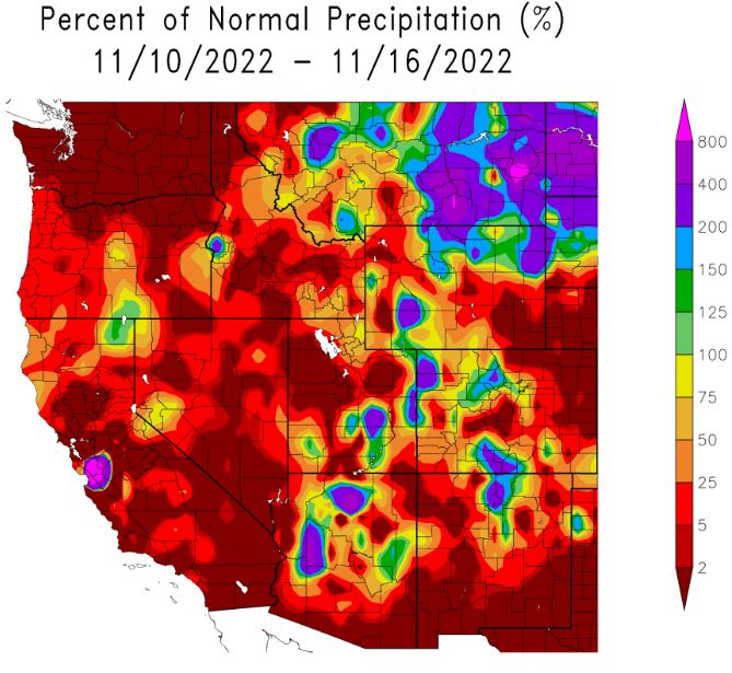

Lots to talk about so will try and make this short and sweet. Right now it looks like we'll be dry through at least Monday morning. Night/morning fog with possible slow clearing will continue over the next couple of days. Calm to very light winds with high pressure = air stagnation.
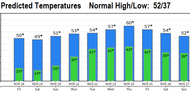
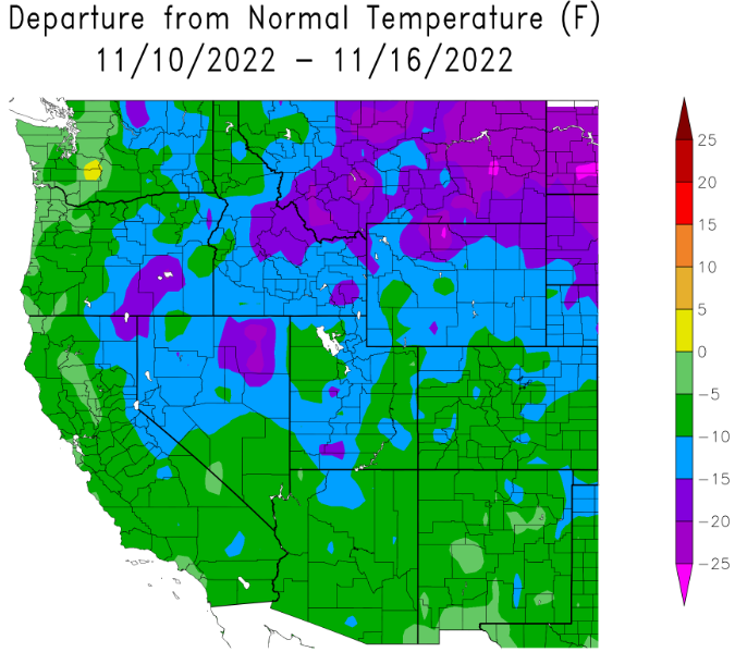
Arctic Air is currently moving into the U.S. from Canada. Cold air is currently east of the Cascades (Bend and Pendleton are running 15-20 deg below normal and Klamath Falls at 10-15 deg below normal). Coldest of air will stay east of the Cascades but our temps will drop some with lows in the mid 20's tonight and Friday night (highs 40-50).

Monday- Tuesday: Looks like a storm may move in later Monday and Tuesday with 1/2" or less of rain. Not a cold system so snow levels 4000'+. Winds 20 mph or less.
Wednesday-Saturday (Nov 26): Dry at this time. No major weather related travel impacts expected through the surrounding states. Be aware of ice possible on roadways due to the recent Mon-Tue storm - especially eastern WA, all of Idaho, NorCal passes, and I-80 north across Nevada.
Sunday Nov 28-Monday Nov 29: Storm system may affect the region. Low accuracy, fuzzy details right now. Will have more on this in updates this weekend and throughout next week.
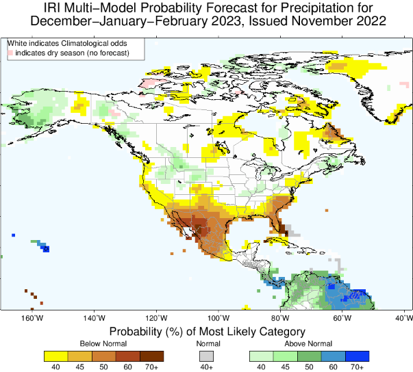
Latest data hints that we may be 70-90% of normal precipitation for the Dec-Jan-Feb period (see image below). Not set in stone, but the large amount of anomalous and strong high pressure that we're seeing is concerning. No signals on when this persistent pattern will break down and let the storm door open without interference. As soon as I see some big changes, you'll be the first to know. Until then, for the next 10-14 days, looks like just a couple of storms with high pressure staying in control of the North Pacific and Western U.S.


