To rain or not to rain is the question of the day. A storm system heading our way has slowed down and weakened. This means that whatever rain falls today into Saturday morning will be light and probably total around 1/10" or less. No wind concerns (15 mph or less). Saturday afternoon through Sunday looks dry.
Halloween Monday: Another storm will bring rain to the area. There's uncertainty at this time as to when the rain will start. Some data is predicting noon, others show 5:00pm. I'm leaning towards 2-4pm right now. Expect showers on Tuesday. It could get a little breezy Monday afternoon, but winds look to be 20 mph or less. I'll have this refined for you in an update on Saturday evening or Sunday morning.
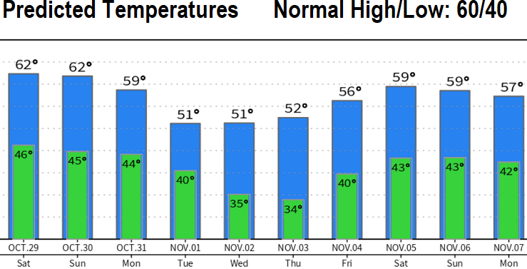
Wednesday through the end of next week looks dry, but it will be cooler. In fact, low temperatures Thursday and Friday mornings may flirt with, or be within a couple degrees of, freezing (see predicted temperatures chart).
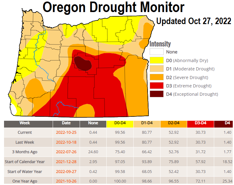
Note: Anomalous and strong high pressure over the North Pacific has been affecting the jet stream and is creating problems with computer model predictions. This is also affecting forecast accuracy. Since Sept 1, we've only had 1.71" of rainfall. This same time last year we already had 7.55" and in 2020, we were sitting at 3.62". Normal for Oct + Sept is 5.18". I'm a little concerned that, because of the anomalous high pressure, we're starting the rainy season off at a deficit with 81% of Oregon continuing with drought conditions. This means that the drought numbers will gradually worsen until we get appreciable and consistent precipitation. However, this is NOT an indication that the rest of the water year will be drier than normal. There's still strong signals (odds) for above normal precipitation November through January.


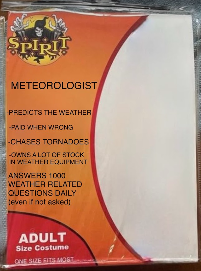
Saw this costume at the Halloween store:
