**AUTUMNAL EUINOX OCCURS THURSDAY AT 6:04pm***

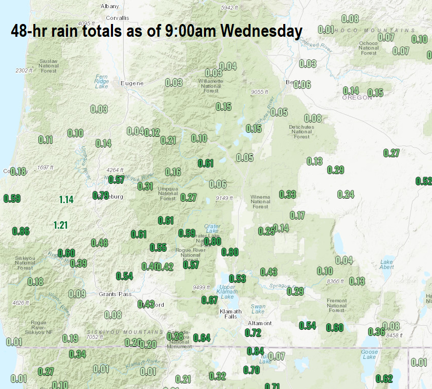
As of 9:00am today (Wednesday), 0.14" of rain has fallen in Cottage Grove. Up to another 1/10" of rainfall is possible through tonight. Check out the map, notice the impressive rainfall totals from about Roseburg south. North of Eugene has been dry so far.

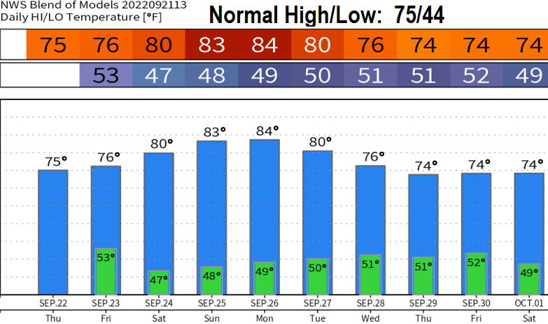
This storm system will be east of us tomorrow morning (Thursday) and the threat of showers will end around sunrise. Dry weather and a warming trend will then be the case through around Sept 28-30 (data isn't in agreement on when our next rain chances will be). Expect night and morning fog. It does look like storm systems will start passing through with regularity beginning around Oct 1-3.
Otherwise, over the weekend and into early next week, highs will probably be around 80 - low 80's but nights and mornings will be cool and crisp. Humidity will also be elevated due to the moisture from our current rainfall, so it could feel a little muggy Sat-Tue.

Winds/Smoke: Winds will mostly blow from a direction that will push smoke from the Cedar Creek Fire away from us. However, winds could shift around at times through Sunday which may bring some smoke into our area.
Tomorrow's post will have updates on the drought, where we stand with precipitation, and outlooks as we move forward (including what's going on with La Nina).