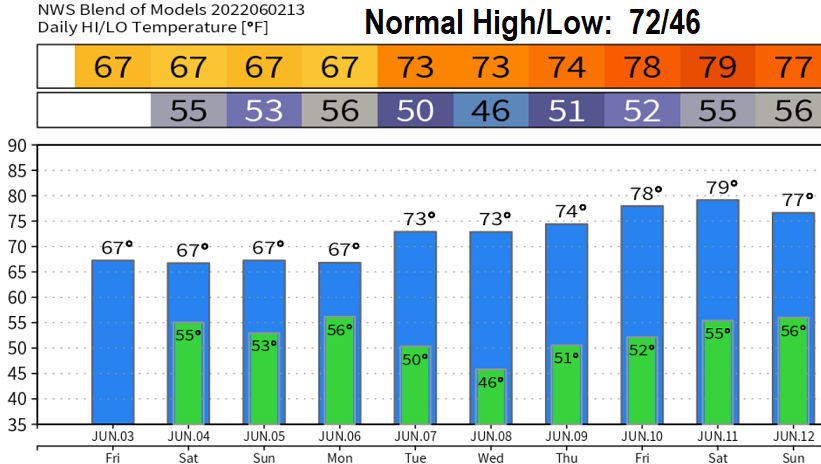
Thursday June 2: Rain/showers throughout the weekend. Although light showers are possible tomorrow (Friday), chances for more steady rain increase Friday afternoon and evening. Lots of moisture will then be pumped into the state Friday evening or night through Sunday morning. Snow levels above 8000'. Total rainfall Friday 1/4" or less. Total rainfall Friday night through Sunday morning 1/2"-1.50". Rain will change over to showers and isolated thunderstorms late Sunday morning. Thunderstorms Sunday afternoon would be capable of small hail and gusty winds.
Wind: At this time, wind gusts are expected to be 20 mph or less. If the system stalls and strengthens, higher winds would be possible. However, right now it doesn't look like a repeat of last weekend's wind event. Strongest winds will occur between Saturday evening and Sunday afternoon and will blow from a south / southwesterly direction.
Although rainfall isn't uncommon this time of year, we usually don't see this much moisture directed into the state during May and early June. May's weather pattern was something that we typically see in March. Same for what's expected this weekend.
The month of May closed out with 6.07" of rainfall. Normal for the month is 2.60". Current regional snowpack is at 158% of average.
Drought: On March 1, 91% of Oregon was in a drought. Today, that number is down to 73% (thanks to all the rain in April/May).
