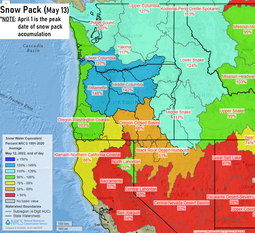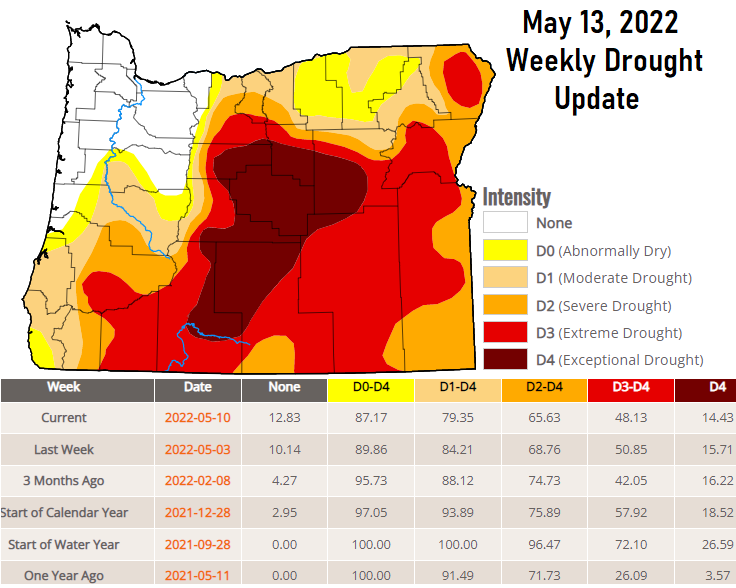
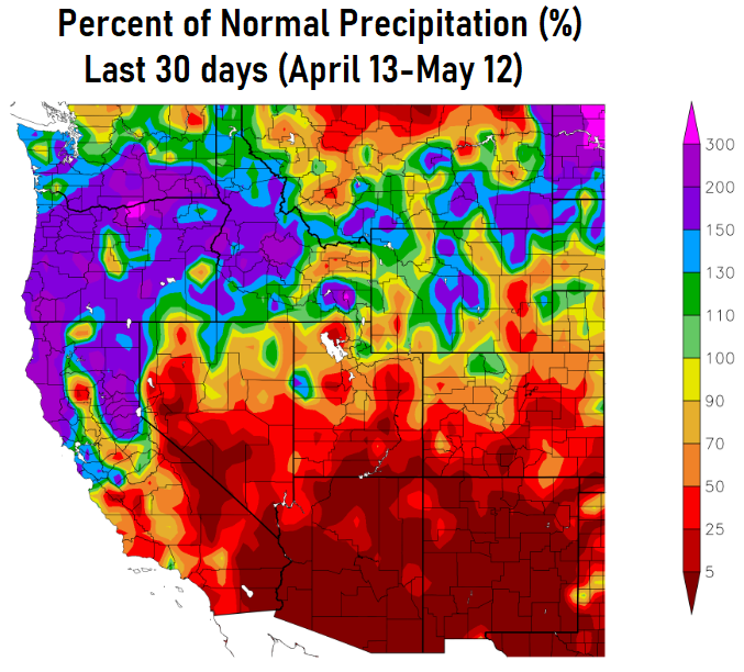
Friday May 13th: Sat/Sun not a washout! WOW: check out the images! This week's update of the Drought Monitor continues to show improvement. The past 30 days is the only time this year that we've seen improvement, since Jan-Mar was very dry with far below normal precip.

In fact, we've had more rainfall over just the past 30 days (5.23") than from the entire 90 day period of Jan-Mar (3.81"):
Many of you are sick of the rain, but the good side of this is that we would otherwise be walking into a potentially dangerous and early start of the fire season. Chances of a rare 3rd year of La Nina are increasing. Latest data signals are for La Nina to stick around into or through next Winter.
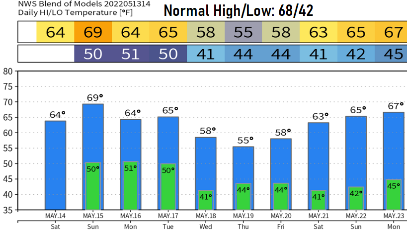
Rain will develop 1-4pm this afternoon and change over to showers early Saturday morning (1/2-3/4" of rainfall). Looks like just light isolated to maybe scattered showers Saturday afternoon with the evening drying out. Sunday and Monday should be mainly dry with only a small chance of an isolated light shower. Skies over the weekend will be partly to mostly cloudy. No wind concerns, breezes will stay on the light side.
