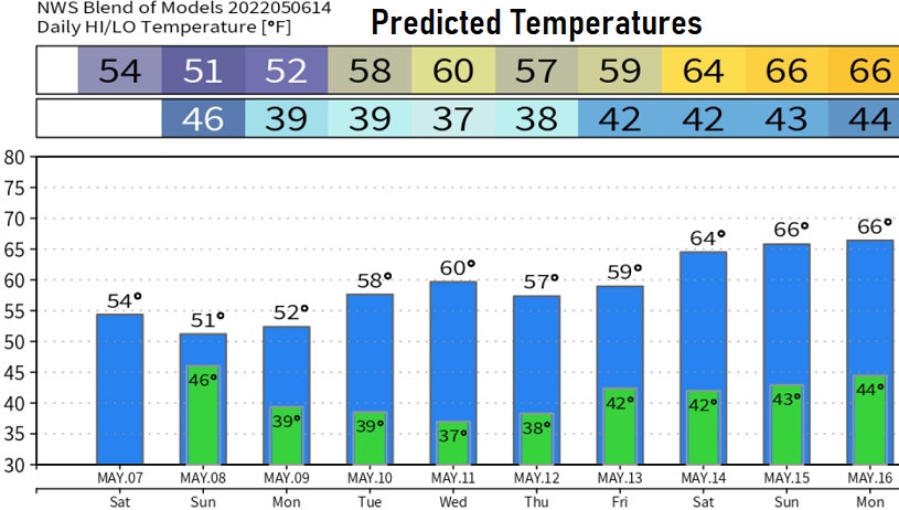
Friday May 6: As of 10am, we've recorded 1.43" of rainfall so far from the series of storm systems that will affect the area through Sunday. About another 1/2-3/4" more is expected through Sunday in the form of showers and isolated thunderstorms. There could be some dry breaks, especially on Sunday. A few showers may linger into Monday. Snow levels above 5000' today, 4000' Saturday, 2000' Sunday.
Winds today can gust up to 20-30 mph and it may remain breezy through this evening. Especially if the stronger winds above us can "mix down" to the surface. Tomorrow and Sunday up to 20 mph.
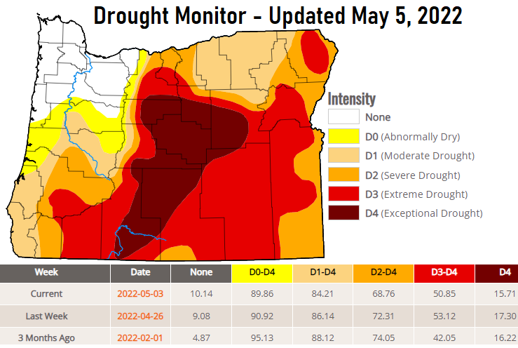
There's about a 2% improvement due to all the precipitation the state has had over the past 30 days. Yes, 2% is a small number but we got to consider without all this rain the drought would be worsening. I know lots of you are sick of the rain and want sunshine, but these late season storms are having a major impact on pushing away what would otherwise be an early start to the fire season. Our region of the snowpack, the Willamette Basin, is at 121% of average. The statewide average is at 152% (double from just 45 days ago!).